ABOUT US
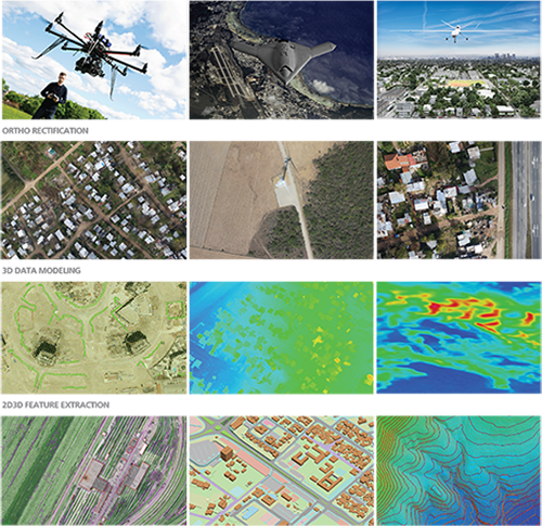
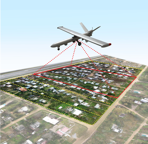
An Unmanned Aerial Vehicle (UAV), commonly known as a drone and referred to as a Remotely Piloted Aircraft (RPA) by the International Civil Aviation Organization (ICAO), is an aircraft without a human pilot aboard. UAVs have opened up a whole new world of surveying, Ortho photo production, 3D modeling and feature extraction possibilities. Due to the massive simplification of the data acquisition stage, compared with conventional methods of aerial capture, the costs involved have been drastically reduced. UAV Data Processing.com (a division of GeoShot Technologies) having a decade of experience in the professional surveying industry, now specializing in UAV data processing and delivers high-quality true ortho photo, contours / DEM / DTM / DSM, and city-wide 3D model to use for a range of urban planning, commercial, utilities, environmental, agriculture and governance requirements. Post-processing is performed using very powerful workstations to handle the massive size of the datasets acquired.